


Show Connector Trails
This trail is located close to or on open water, wetlands, or floodplain. Please use caution and be alert for water near or on the trail. Be alert for flooding and swiftly moving water. Check with your local trail manager for more information on closures during periods of high water.
Trailhead Information
Kiwanis Trail access and parking is available in Rock Island at Ben Williamson Park (44th Street & Rock River) and in Moline at Green Valley Park (60th Street & 50th Avenue) and Harold's Landing (North Shore Drive and 52nd Avenue).
Description
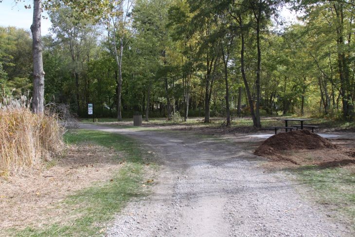
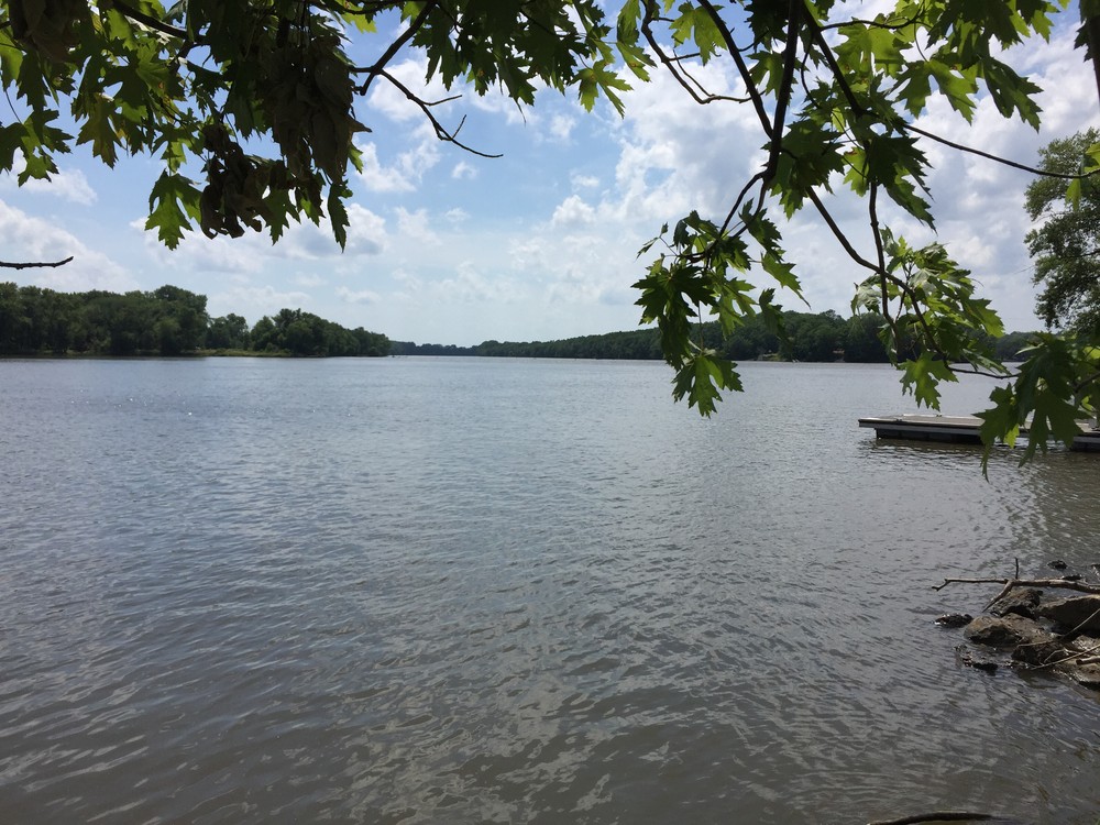
With a mixture of a dedicated bike path and paved roads, this trail is perfect for cyclists, walkers, and runners of all abilities. The trail boasts many amenities, including spectacular views of the Rock River. The terrain is flat and surface is crushed stone, asphalt, and concrete. The trail passes through Ben Williamson Park, Harold's Landing, and the Green Valley Nature Preserve and Sports Complex. With one end at Ben Williamson Park in Rock Island, the trail continues for 6.5 miles to the east through Moline ending at 60th Street and Green Valley Park.
Other Information
The Kiwanis Trail is part of the Hennepin Canal Parkway Trail, which runs through the Hennepin Canal Parkway, a 104.5-mile linear park in total, spanning five Illinois counties from the Mississippi River to the Illinois River.
There are plans to extend the Kiwanis Trail east from 60th Street upriver to connect into the Great River Trail, American Discovery Trail, and the Hennepin Canal State Parkway Trail in Colona, most likely via 38th Avenue and John Deere Parkway.
The Rock River Trail is a system of recreational trails on and along the Rock River that goes through 11 counties in Wisconsin and Illinois. This QC Trails featured trail is part of that network. The Rock River Trail was established in 2010 to promote recreational use and appreciation of all 320 miles of the Rock River. Visit the trail online to learn more about how to hike, bike, paddle, horseback ride, drive, fly, or appreciate history, art, or chocolate along the trail!
Elevation Profile
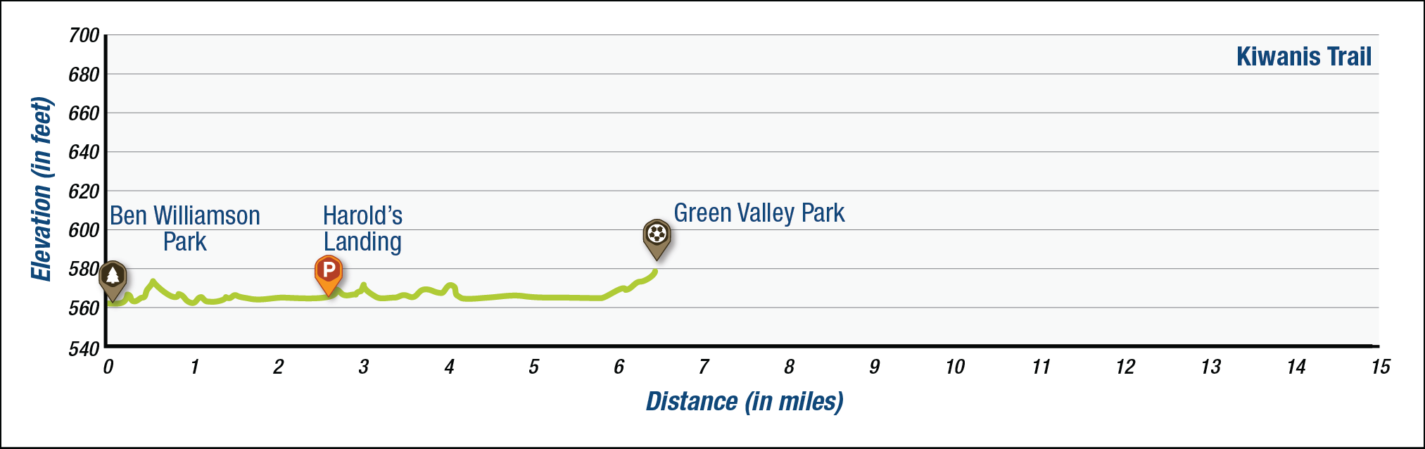
The elevation profile above approximates terrain along the specified section of trail and is provided for general information. Use your best judgment to choose trails with elevation changes to match your comfort level. See QC Trails Terms of Use for more information.
Trail Managers
Visit the City of Moline or the City of Rock Island online for more information and a downloadable map or contact:
City of Moline, Illinois
3635 4th Avenue
Moline, IL 61265
Phone: (309) 524-2424
ybrolander@moline.il.us

City of Rock Island, Illinois
Parks and Recreation Department
4303 24th Street
Rock Island, IL 61201
Phone: (309) 732-7275
parkrecmail@rigov.org
Photos
Comments

Barb Wlaskolich - April 10, 2017
Well maintained trail and nice ride through quiet neighborhoods.
Meredith Witherell - June 30, 2016
Nice trail; a bit rough in sections but overall a pleasant ride.