

Show Connector Trails
This trail is located close to or on open water, wetlands, or floodplain. Please use caution and be alert for water near or on the trail. Be alert for flooding and swiftly moving water. Check with your local trail manager for more information on closures during periods of high water.
Trailhead Information
Access in Rapids City can be found at Shulers Shady Grove Park with amenities such as a public boat ramp with parking lot, park and scenic overlook of the Mississippi within a gazebo.
Description
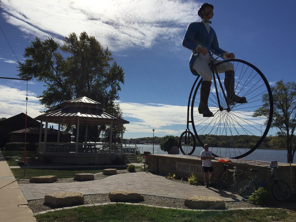
The Great River Trail continues its course parallel to the Mississippi River along this link between the Villages of Rapids City and Port Byron. Trail users will get splendid views across the "Mighty Miss" and will often see plenty of wildlife along the way. The asphalt and concrete surface provides an easy to moderate trail experience in terms of effort.
The Great River Trail (GRT) runs beside the Mississippi River through the Quad Cities region from Sunset Park in Rock Island to the Rock Island County-Whiteside County line. This section of the GRT is part of the larger 66-mile GRT mile trail system that extends from Rock Island, Illinois at its south end to Savanna, Illinois at its northern terminus. The GRT is widely used as an alternative transportation link and for both active and passive recreational benefits. In addition, the trail provides access and connections to neighborhoods, commercial districts, industrial areas, recreational areas, and historical landmarks. The trail parallels the Great River Road National Scenic Byway (Illinois state highways 92 and 84) throughout the region.
Other Information
The Great River Trail is also part of three other significant trail networks: the Mississippi River Trail (MRT), the American Discovery Trail (ADT), and the Grand Illinois Trail (GIT). The MRT is a 3,000 mile trail system that follows the Mississippi River from the headwaters in Itasca, Minnesota to its delta at the Gulf of Mexico near New Orleans, Louisiana. The ADT traverses the U.S. coast to coast from California to Delaware for more than 6,800 miles across 15 states. As it loops more than 500 miles between Lake Michigan and the Mississippi River, the entire Grand Illinois Trail joins together existing and proposed state and local trails to create the state’s longest continuous trail. It hugs historic canals, crosses unglaciated hills, parallels the Rock and Fox Rivers, and includes one of America’s first rail-trails.
Elevation Profile
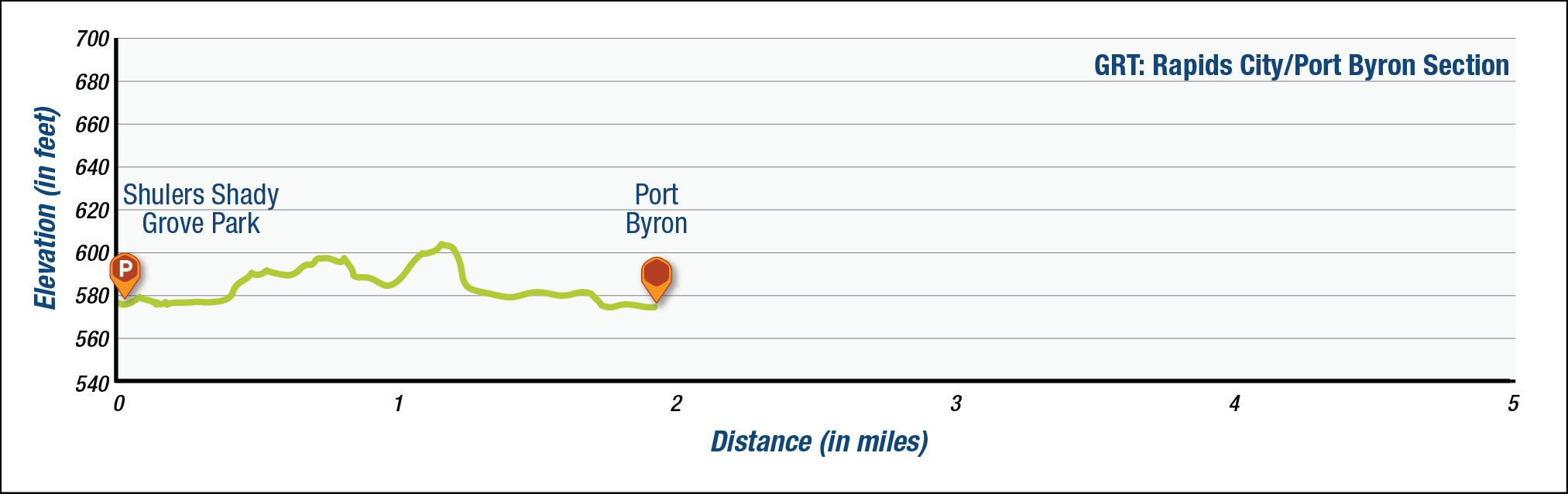
The elevation profile above approximates terrain along the specified section of trail and is provided for general information. Use your best judgment to choose trails with elevation changes to match your comfort level. See QC Trails Terms of Use for more information.
Trail Managers
Visit the Village of Rapids City, the Village of Port Byron, or the Rock Island County Forest Preserve District online for more information or contact:

Rock Island County Forest Preserve District
19406 Loud Thunder Road
Illinois City, IL 61259
Phone: (309) 795-1040
jcraver@ricfpd.org
Village of Port Byron, Illinois
P.O. Box 438
120 S. Main Street
Port Byron, IL 61275
Phone: (309) 523-3705
portbyronclerk@mediacombb.net

Village of Rapids City, Illinois
P.O. Box 134
1204 4th Avenue
Rapids City, IL 61278
Phone: (309) 496-2321
r.village@mchsi.com
Photos
Comments
No comments.